If you don’t mind swimming with Crocodiles and you don’t need waves then this list of Top End Airports is for you. I found these airports while searching for Australia’s best Beach Airports. They didn’t make the shortlist but they are definitely worth a look.
Of particular beauty are the 3 Western Australian beachside Airports on the list. You won’t see much here from the Northern Territory unfortunately, the coastal waterline isn’t so pretty. The Gulf of Carpentaria on the Queensland side gets a bit better and we finally wrap up the show with Cape Flattery which has some of the purest silica sand in Australia. Let’s get into it!
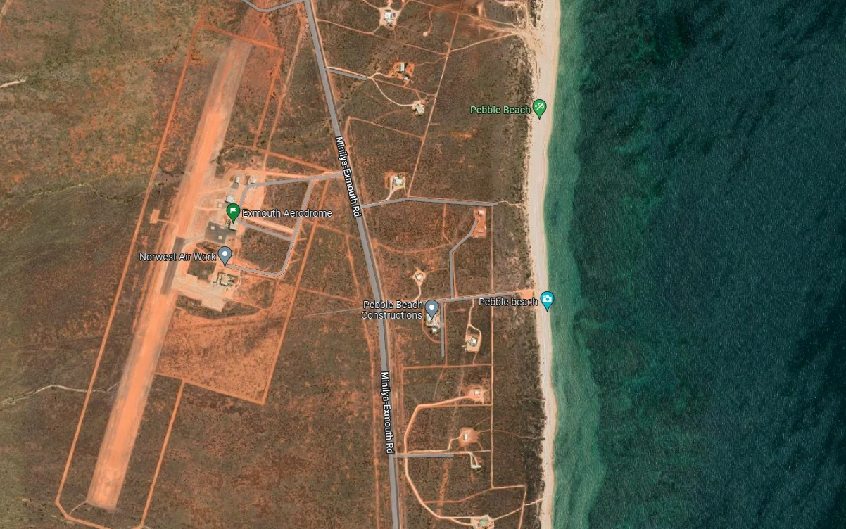
Exmouth Aerodrome is situated on Exmouth Cape, 1115 km north of Perth and 962 km southwest of Broome. The aerodrome sits 11 km south of the town of Exmouth which was originally established to support the nearby United States Naval Communications Center that was established in the 1960’s.
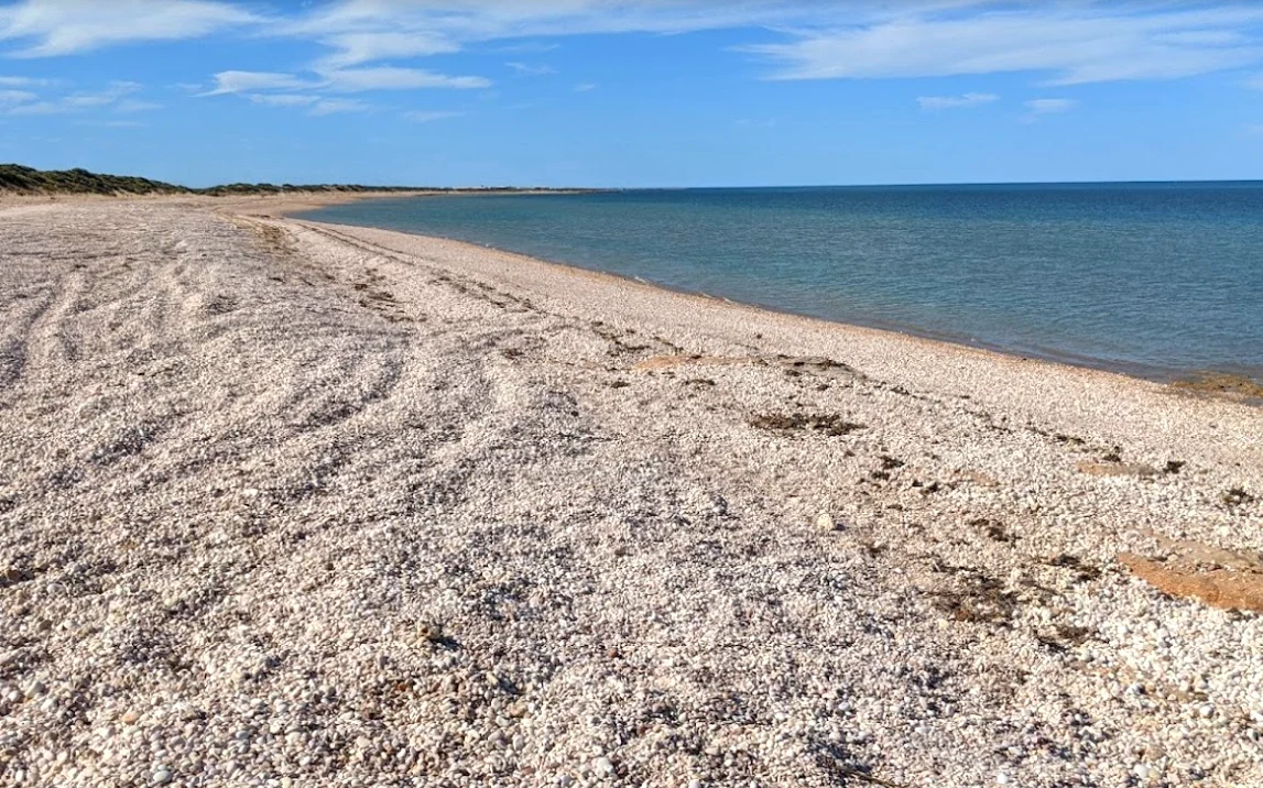 Pebble Beach, a short walk from the Aerodrome
Exmouth Aerodrome is nothing fancy – It has a 1270 m dirt runway that is 30 m wide. Just a short 1 km walk away is a lovely beach called Pebble Beach. As the name suggests it has a rocky beach instead of the usual sand.
Just behind the airport is the picturesque Cape Range National Park which has spectacular rock formations and beaches.
A further 20 km south of Exmouth Aerodrome is the Learmoth Australian Airforce base which is one of only a handful of shared Military/Civil airports. The Military still approves who can land on the lovely 3000 m runway which happens to be the 14th longest runway in Australia.
This whole area is on a similar latitude to Rockhampton and it took second place in my Best climate in Australia study.
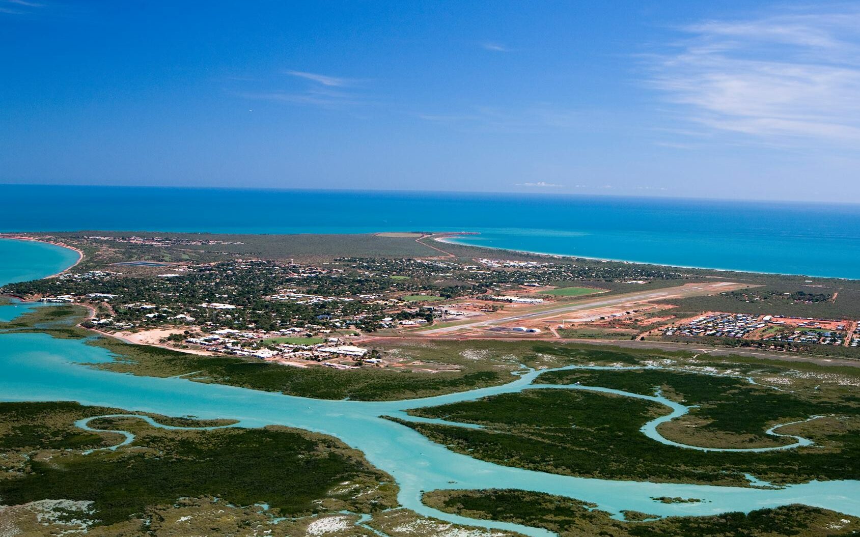
Broome International Airport is located 1683 km northeast of Perth on the same latitude as Mission Beach on the east coast. The town has a population of around 15000 which has grown significantly since the town was formed to support the Perling industry in the late 1880s.
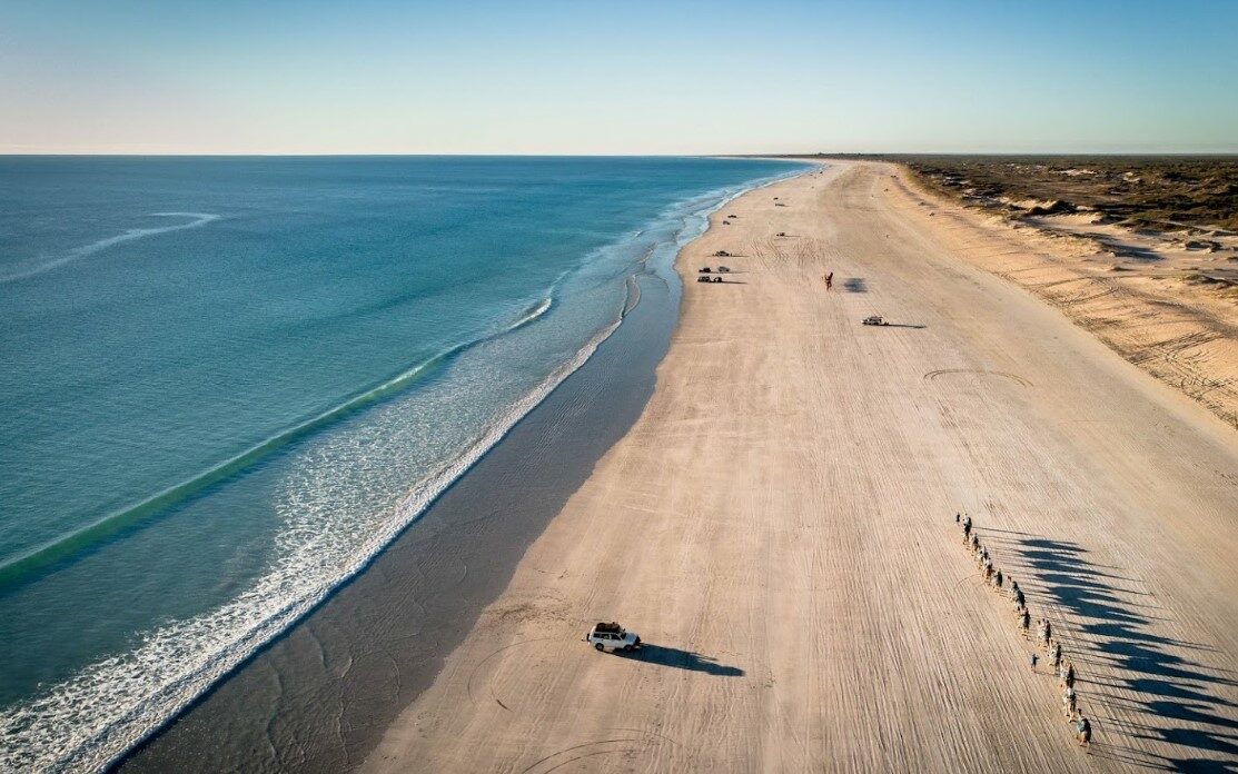 Cable Beach on the west side of the airport
The runway is 2200 m with an extended threshold of an additional 330 m. This is a bit on the short side to support wide-body aircraft.
Most of the flights landing in Broome are from Perth or regional WA. Occasionally there are flights from Sydney and Melbourne when demand is high enough.
Broome is a gateway for mining operations in Western Australia as well as supporting a modest $320 million tourism industry.
Landing and parking fees at the airport are reasonable at $25 a tonne. There is also a $44 parking fee which is reduced to $15 per day for long-term stays.
At the west side of the airport is a beach that resembles a highway so watch out for 4WDs and Camel safaris. The beach is called Cable Beach because of the 1650 km long Submarine Telegraph cable that was laid in 1889 between Java in Indonesia and Broome. It completed the connection between Australia and England. Other cables were also laid like the one between Java and Darwin but they needed redundancy because the cables had a tendency of breaking with seismic activity.
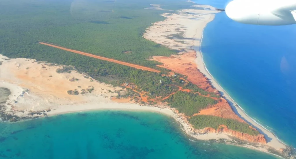
Cape Leveque Airstrip is at the top of the Dampier Peninsula, 185 km northeast of Broome. Cape Leveque gained its name from a French explorer who sailed along the coast in 1803. The whole area is now Native title land that has been returned to its traditional Aboriginal owners.
The airstrip on the site was built in 1955 to better support the operation of Cape Leveque lighthouse which was constructed in 1911.
Since construction, the dirt airstrip has been extended to 1260 m and is operated by the local Aboriginal council. It has been used to ferry-in tourists and helps service the Aboriginal community-run Kookjaman Bush resort.
Permission to land at the strip needs to be granted by the local council. The site has been closed since COVID as the resort needs major repairs to bring it up to standard. The Aboriginal community is trying to secure investment.
As you can see from the picture, the beach and red rock formations are incredibly beautiful. The beach is only a short 350 m walk from the airstrip.
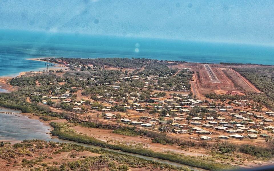
Mornington Island Airport is located in the south of the Gulf of Carpentaria on the same latitude as Port Douglas but 670 km away.
The island is an Aboriginal community that started out as a Presbyterian Mission in 1914. It has gained its independence and is now self-governed.
Alcohol was banned on the island like in many Aboriginal communities which led to protests and home brewing which turned out to be even worse. Now there are heavy restrictions on alcohol but it is not outright banned.
The Airport of the island draws its history back to the Australian Airforce during the war and now is under the administration of the local Aboriginal Council. The length of the runway is 1520 m. There is a minimum landing fee of $106 or €53 per tonne which is on the pricy side of things.
There are plenty of beaches around the airport and you might even get lucky enough to see Australian native Brolgas.
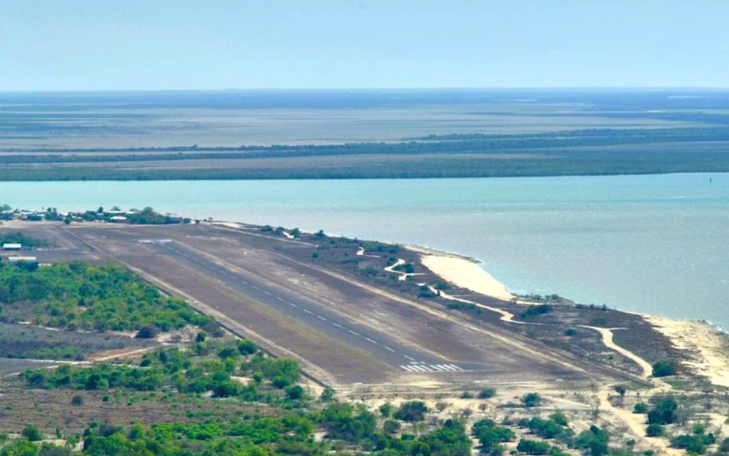
Kurumba Airport is located 528 km west of Cairns and 1206 km southeast of Darwin at the base of the Gulf of Carpentaria. In the late1930s where the town is now was a refueling station for QANTAS flying boats on their way to London. During the war, it was used for the same purpose by the Australian Airforce.
After the war, the area developed into a successful Commercial Fishing town for Crabs, Prawns, and Barramundi. Today it serves as the center of Gulf fishing. There is also a modest tourism industry. This is the town’s website.
The Kurumba Airport is 1380 m long and 30 m wide and serves as a lifeline to the town which can be cut off during floods. The airport is owned and operated by the local council. Landing fees are $19 per tonne.
Just 100 m from the airport is a nice beach. Be sure though to keep an eye out as this is crocodile country, especially near the mouth of the Norman River.
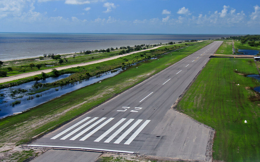
Pormpuraaw Airport sits 285 km north of Kurumba Airport we just looked at on a similar latitude to Lizard Island in the Great Barrier Reef.
Pormpuraaw community that is located here was originally set up as a smaller Anglican Mission after the nearby larger Kowanyama mission was struggling to keep peace due to the fact that they had brought too many different tribes together into the same area.
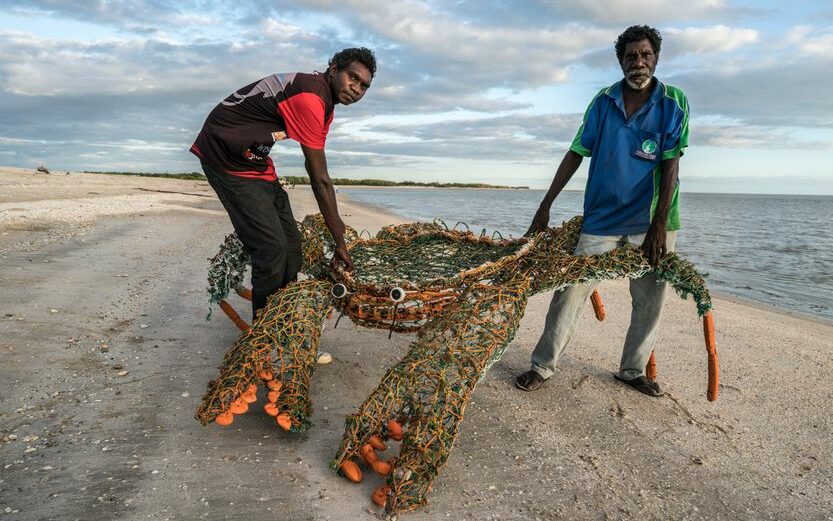 Local artist show off their creation on the beach
Women and children were removed from cattle stations in the region and sent to the mission dormitories where they were educated and made to become good Christians. Due to the fact that rations were not enough they were still expected to gather Bush tucker to support themselves.
Today the land has been returned to the Aboriginals and the community is thriving. There is a vibrant art scene and growing tourism aspirations. The local Aboriginal council runs a Guest house for visitors and there are also camping possibilities. Just opposite the airport is a nice sand beach.
The airport has a 1360 m paved airstrip with a parking apron. Airline Skytrans runs scheduled flights to Cairns and neighbouring communities. The Airport is run by the council but they have not published landing fees on their website.
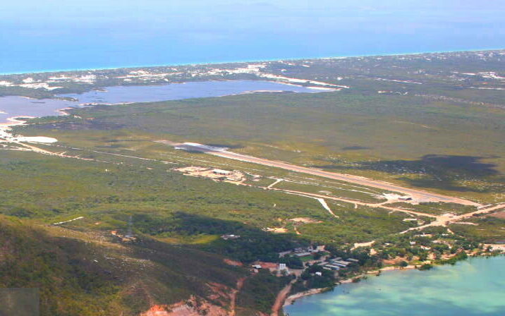
Cape Flattery Airport is located 220 km north of Cairns just southwest of Lizard Island. This site has been home to Cape Flattery Silica mine since 1967 having some of the most pure product in the world. Mitsubishi bought the mine in 1977 and put a deep port in during the mid 80s.
The airport here is used to ferry in workers and supplies from nearby Cooktown and more distant Cairns.
The runway is a sealed 1000 m strip which is more than enough for Cessna Caravans which are the workhorse of the Australian bush.
As the airstrip is owned by the mine they would need to grant the landing permission. From the airstrip it is less than 500 m to the beach.
As you can see from the picture, the beaches here are spectacular and there is public assess to the beach which is popular with 4WD enthusiasts. There are several camping areas on the beach.