Australia has a bunch of airports right on the coast within a short walk of beautiful beaches. I covered a few of them in the article on the 22 Best Beach Airports of Australia but not all of them could make it in that short list. These 10 airports definitely deserve a mention and maybe a landing if you are in the neighborhood.
The airports are found from Rainbow beach in southern Queensland right down to Mallacoota just over the Victorian border, covering a distance of around 1400 km or 870 miles. The list runs from north to south to make it a bit easier to follow.
Some of these airports (6 of 10) were built or requisitioned by the Australian Airforce as landing zones and refueling points for aircraft patrolling the east coast for Japanese Submarines during WW2. The Japanese managed to sink 48 ships in Australian waters, and would have sunk a lot more if it wasn’t for the patrols.
Let’s jump right into the list.
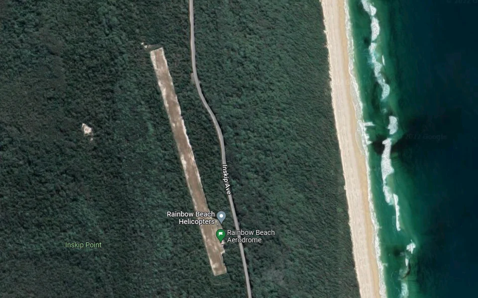
Rainbow beach Airstrip doesn’t have any war history but it sure is in a nice location just south of UNESCO listed Fraser Island. The airstrip itself is located 6 km north of the chilled-out town of Rainbow beach, 175 km north of Brisbane. From here many 4WD adventurers either head down into the Great Sandy National Park or take the nearby Inskip barge to Fraser island.
The Airstrip is a 970 m grass/sand strip and is home to Rainbow Beach Helicopters who do scenic flights around Fraser Island. There is also some local Gyroplane activity.
 Rainbow Beach
I didn´t manage to find any other information about this airstrip. It is marked in the Bundaberg VNC as a private airstrip but there is nothing in the ERSA about it. There was supposed to have been an aircraft accident there in 2013 but I did not find reference to it in the ATSB Accident database.
From the airstrip, it is a 550 m walk to lovely remote beaches that are frequented by horse riders from the local Rainbow Beach Riding stable.
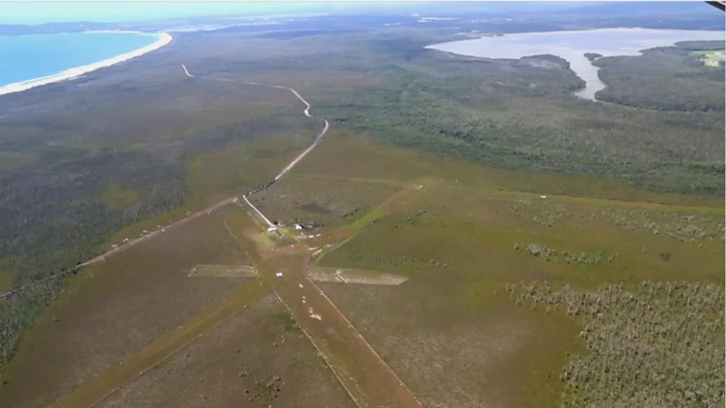
Teewah Airstrip is located 10 km northwest of the affluent and beautiful town of Noosa Heads. It is our first WW2 airport built buy the Australian Airforce in the late 1930s. It is quite easy to recognize these old military landing sites due to the multiple runways which minimized cross wind landings as well as made them easier to see from the air.
The Airstrip was a Commonwealth land until it was handed over to the local government and designated as a Historic Conservation area. There has been an ongoing dispute between Environmentalists and Aviation enthusiasts who have different visions for the site.
 Camel rides on Teewah Beach
When checking in 2022 the site was not registered as an airport in the aviation maps (Bundaberg VNC) did show possible ultralight and hang gliding activity around the area. At least in 2016, it was being used in this video.
There has been some backlash from local residents who don’t want to see it developed further as an airport.
If the grass is short enough and you do manage to land on one of the 800 m strips you will enjoy a pleasant 1.6 km walk to the pretty Teewah Beach.
Don’t be surprised if you run into a camel safari or horse riding group as there are several tour operators who provide treks along the beach.
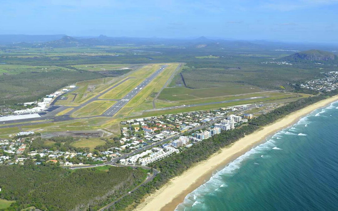
The Sunshine Coast Airport is located 98 km north of Brisbane. It started life as a simple General Aviation airport with a grass strip in 1959 and has been continually upgraded since.
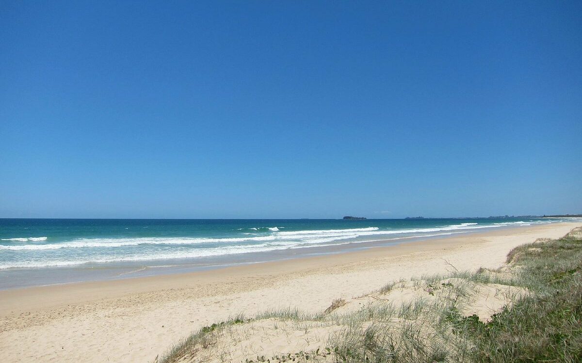 Marcoola Beach, Sunshine Coast
The last major overhaul was in 2020 when the former 650 m sealed runway was replaced with a 2450 m 13/31 runway, making it possible for wide-body aircraft like the Boeing 787 and Airbus A330 to operate from the airport, opening up the Asian market for the region.
The shorter 12/30 runway with a length of 1747 m was decommissioned during the upgrade. (at the time of writing, Google maps still showed the former runway but the picture above is accurate for how it looks today. This video also shows an aircraft landing on the new runway.
As the bird flies, it is only 1 km from the airport terminal to the beach but due to the location of the terminal building, it’s a 2.5 km walk around the security fences.
Beaches on the Sunshine Coast are lovely and the atmosphere is a bit less crowded than the Gold Coast as the area is less developed. Maybe that will all change now with this fancy new runway.
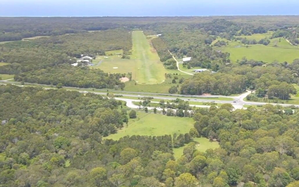
Tyagarah Airfield is one of my favorites and located just 9 km northwest of world famous Byron Bay. This part of New South Wales has lovely unspoiled beaches and the perfect climate. Close by is the dormant Mt Warning Volcano which is now blanketed by lush sub tropical rainforests. The airfield is just 47 km north of to the Gold Coast Airport which is well connected with commercial flights to the rest of Australia.
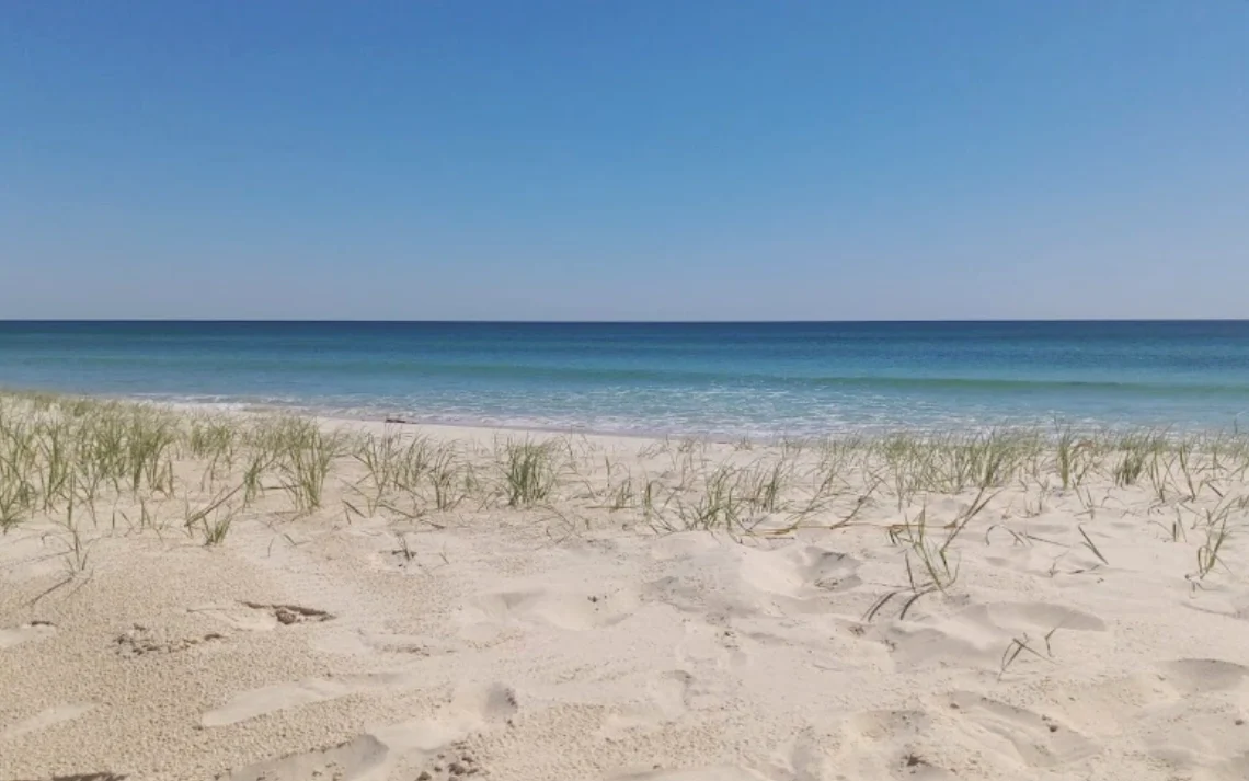 Tyagarah Beach 1 km east of the airfield
Tyagarah Airfield has a compact 1000 m grass/sand strip which is operated by the Byron Shire Council. The airfield has some of the most reasonable landing fees you will find on the east coast of Australia with Ultralights permitted to land for as little as $6. This is very surprising given how popular and expensive this region has become.
The airstrip is around a 1 km walk to Tyagarah beach where you will find pretty turquoise water and light-colored sand.
Skydive Byron operates Cessna Caravans from the airfield and regularly takes customers up to 14,000 feet. There is a Gliding club at the far end of the runway and a Gyrocopter club next to the skydiving center. This youtube video gives a nice overview of the surrounding scenery.
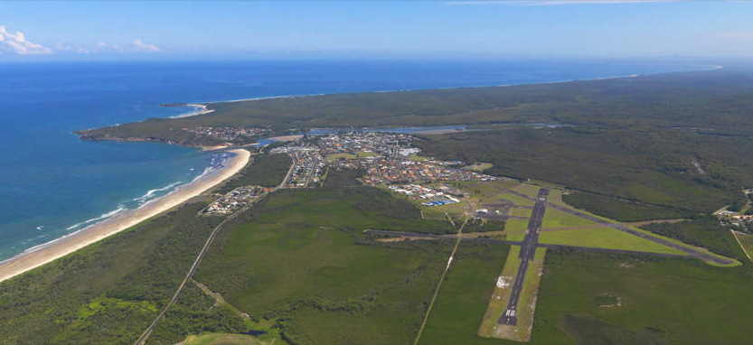
Evans Head Memorial Aerodrome is heritage-listed airport located 105 km south of the Gold Coast. It was built by the Australian Airforce in 1936 and served as a Bomber training school during the war. In its heyday, it had 3 sealed runways and a grass strip. Today only runway 18/36 is in service and has a length of 1300 m.
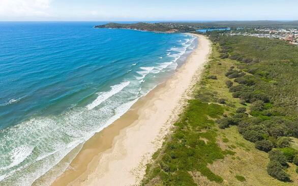 Airforce Beach, is a short walk from the airport.
The airport has experienced its share of controversy since the local council gained control of the airport in 1992. They have tried to subdivide much of the land and develop it in ways that are in conflict with the agreement they signed to gain control of the land. This has angered many people in the aviation community and veteran groups.
Today the airport has an Air museum and Airpark. There are no fueling services and only day VFR flights are allowed. Landing fees are $20 and parking fees are $25 for aircraft staying over 14 hours.
Getting to Airforce beach is an 800 m walk from the airport. 4WD access to the beach is also permitted so be careful where you put down your sunglasses.
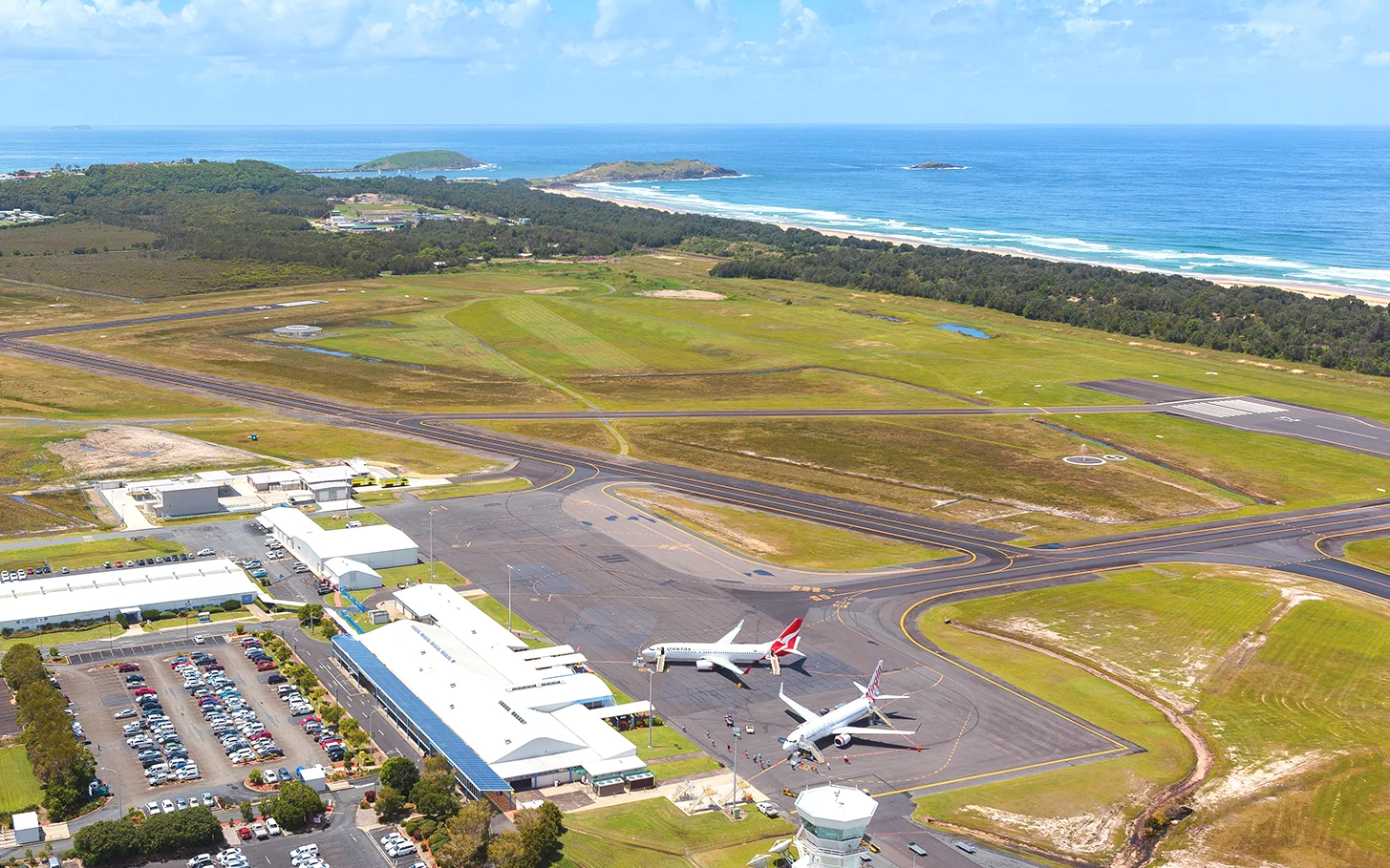
Coffs Harbor Airport is located 430 km north of Sydney and 318 km south of Brisbane. The airport was built in 1928 and was requisitioned by the Australian Airforce during WW2.
Today it has a 2000 m runway that runs parallel to the beach and a shorter 720 m runway (900 m with extended threshold) running east-west.
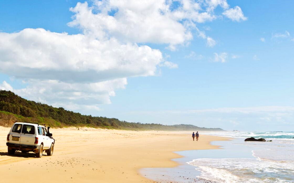 Boambee Beach opposite the airport
The airport is serviced by flights from Sydney, Melbourne, and Brisbane and is a hub for smaller regional airports like Armidale.
Coffs Harbor has all the charm of a country town without all the crowds you find elsewhere.
Landing fees are very reasonable currently set at $13. There is parking in the General Aviation section on the north side of the airport.
To get to the beach is a 2.5 km walk around the fenced perimeter of the airport. There is also the option of walking a little further to the north to Jetty Beach which is a bit calmer and sheltered.
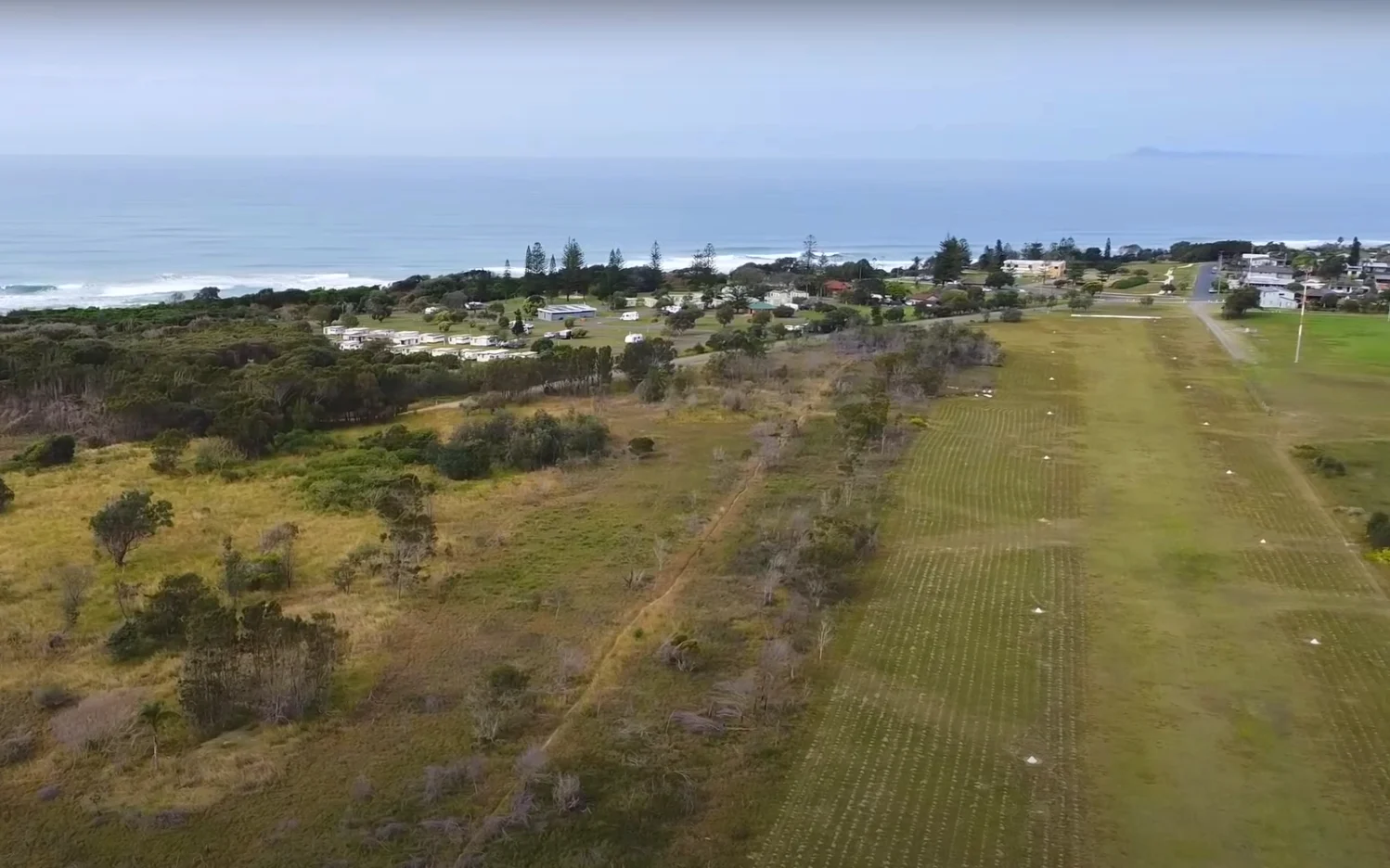
Old Bar Heritage Airstrip is located 133 km north of Newcastle and 15 km southeast of Taree. The airstrip was constructed in the early 1920s as a refueling base for aircraft flying the Sydney to Brisbane transport route. It was used by the Australian Airforce during the war and has now been heritage listed. You can read more about the airstrip’s rich history here.
The runway is a short 540 m grass on clay strip that should be suitable for most recreational aircraft. It is managed on behalf of the Taree council by a voluntary organization. Finding airport information was very difficult leading to the conclusion that current management might be more interested in historical preservation than aircraft operations.
There was an interesting crash back in 2011 when a light aircraft collided with a Ferris wheel when attempting a go-around on the strip during a festival (Watch the video here as it unfolded). Fortunately no one was hurt but the 2 kids on the ride ended up getting a nice $1.5 million payout.
Back to nice beaches, you should find a standard yellow sand beach a mere 250 m from the airstrip. There is some limited aircraft parking both on the east and west side of the airstrip.
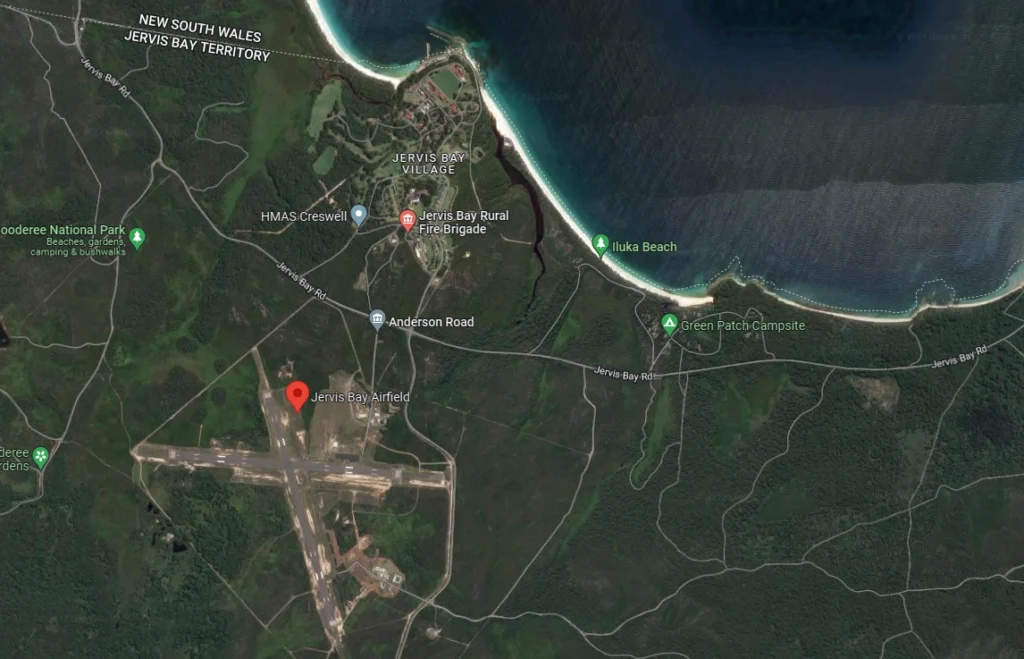
Jervis Bay Territory is a small enclave peninsula in New South Wales that belongs to the Australian Capital Territory. Someone in Canberra decided they needed a Navy Base, all be it 150 km away.
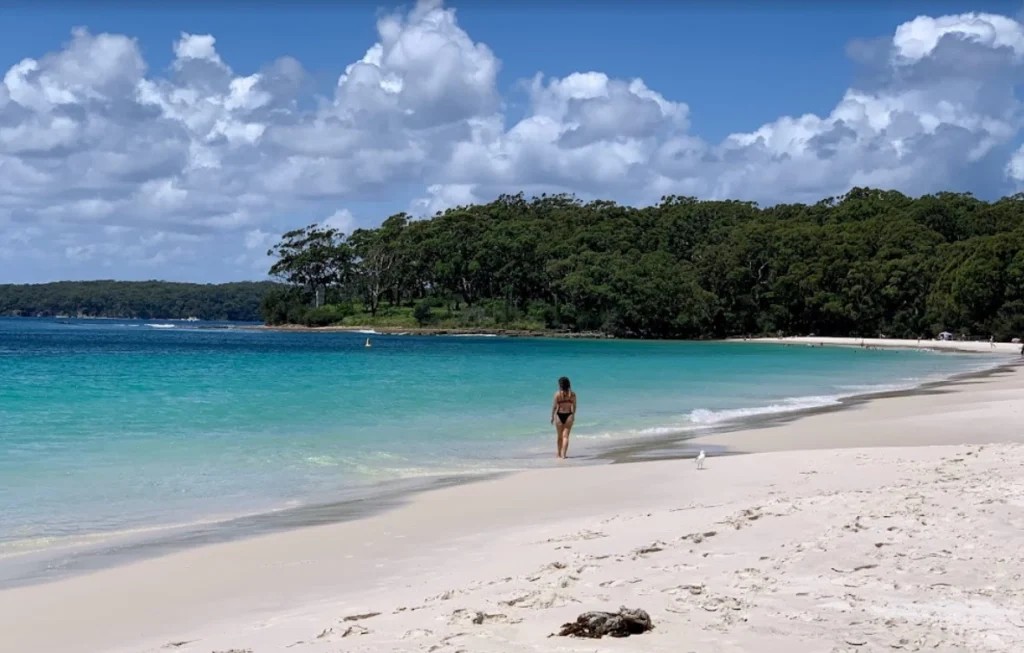 Iluka Beach in Jervis Bay Territory
Public access to the Jervis Bay Airfield and HMAS Creswell Navy College (to the north) is prohibited, but the rest of the peninsula is open to the public and part of the Booderee National Park.
From what I can gather from the aviation charts (Sydney VNC), the airspace above the airport is restricted by NOTAM, and that doesn’t happen so often, so you should be able to fly over the peninsula.
If you were able to walk from the airport it would be a 2 km walk north to Iluka beach. As you can see from the picture, this part of Australia is absolutely gorgeous and is reputed to have the whitest beaches in the world.
It was quite difficult to find information on this airport. The best info I could find was in the Australian AIP ERSA FAC.
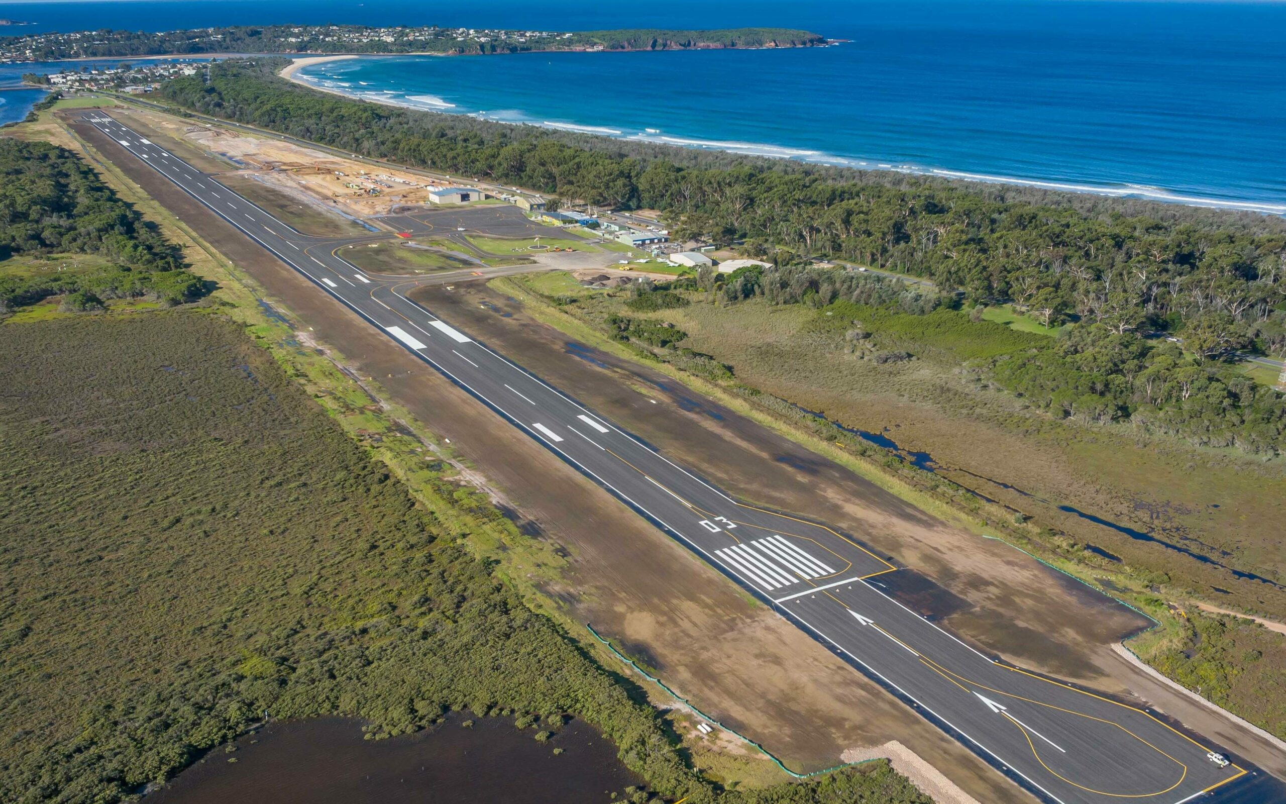
If you want to get away from the crowds of Sydney and Melbourne it doesn’t get much better than Merimbula and its neighboring town Pambula – You will find plenty of pretty beaches and beautiful estuaries with very few people around. (Driving distances: Canberra 3 hrs, Sydney 6 hrs, Melbourne 7 hrs)
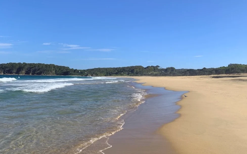 Merimbula Beach is 300m from the Airport terminal.
Merimbula Airport is situated right next to the beach. With a runway length of 1600 m, it is perfect for regional operations. Qantas runs Saab 340 Turboprops providing daily flights to Sydney and Melbourne. Flight time is just over an hour seats sell for around $300.
Landing fees for Single Engine aircraft are $12 and there are no parking fees for stays less than 7 days.
The airport is gated for security reasons so you need to have an Australian ASIC card.
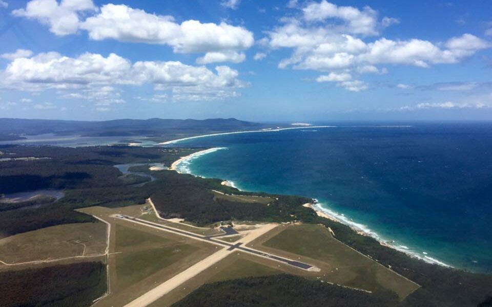
On the border of Victoria and New South Wales is the charming coastal town of Mallacoota and its airport a further 5 km to the southwest. The town and airport are nestled between 2 national parks. This part of Coastal Australia is known for its remoteness and unpredictable weather.
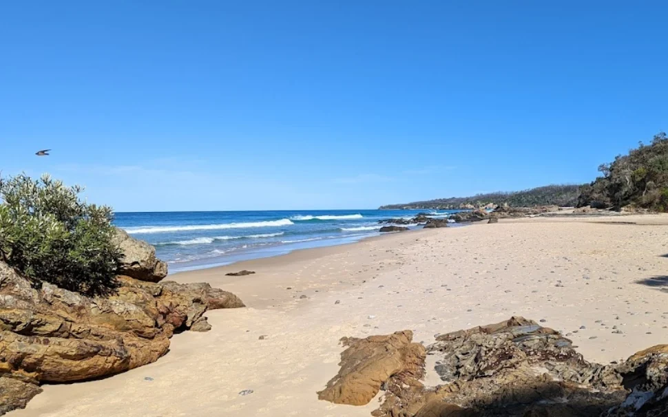 Quarry Beach to the east of Mallacoota Airport
Mallacoota Airport’s main runway 18/36 is a sealed 1028 m by 18 m strip with pilot-activated lighting. The second runway 07/25 is unsealed, shorter and wider with dimensions of 881m by 30 m.
The airport was home to an Australian Airforce squadron during WW2 and has since been improved. The airport lost its certification in 2022 when the council did not do upgrades required by new regulation. This mostly impacted IFR procedures.
Interestingly the local council is not charging landing or parking fees at the moment. That might change after required upgrades to reobtain certification.
There are plenty of nice beaches close to the airport including Quarry Beach and Secret Beach. Odds are you might even have the beaches to yourself, especially if you visit off-season.
If you are interested in the WW2 history of the airport you can read about it here and here.